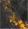
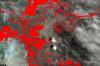
Recommended Practice: Flood Hazard Mapping

This practice shows how GIS and modelling is used to calculate simulated inundation areas based on land use, soil, elevation, and meteorological data. Flood simulations can be used to support decision making regarding potential land use changes.