Japan

Alpha 3
JPN

Related Content

Article

基于天基雷达的热带气旋监测和预报

Translated by Dr. Mengyi Jin

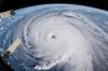
夏季来临时,热带气旋常在沿海地区引发洪涝灾害。早在古代,中国沿海的渔民就通过观察天气现象来预测热带气旋的来临,例如云层的形状和晚霞的变化。热带气旋发生在全球各地,不同地区对它的称呼也有所不同。在北大西洋、中北太平洋和东北太平洋地区,人们通常称之为“飓风”;而在西北太平洋地区,热带气旋常被称为“台风”。

近年来,热带气旋对美国、中国以及其他亚洲国家造成了重大损失。因此,发展基于太空的热带气旋监测技术,预测其路径并进行预警,对于保障民众的生命安全、保护渔业生产以及海上作业等具有重要意义。

双频降水雷达(Dual-frequency Precipitation Radar,简称 DPR)是由美国国家航空航天局(NASA)与日本宇宙航空研究开发机构(JAXA)联合开发的天基雷达系统,其搭载于热带降雨测量任务(TRMM)和全球降水观测计划(GPM)的卫星上(https://gpm.nasa.gov/missions/GPM/DPR),用于热带气旋的监测与科学研究(NASA,2018)。

Tropical cyclones monitoring and forecasting using space-based radar

During the summer season tropical cyclones (TC) tend to cause flood disasters over coastal areas. In ancient times fishermen along the coast of China predicted the coming of tropical cyclones by observing weather phenomena. They observed the shape of clouds and the sunset glow to anticipate them. Tropical cyclones occur in various places where they are named differently as well. In the North Atlantic, central North Pacific, and eastern North Pacific the term hurricane is used. The same type of disturbance in the Northwest Pacific is called a typhoon.

Map

Disclaimer: The designations employed and the presentation of material on this map do not imply the expression of any opinion whatsoever on the part of the Secretariat of the United Nations concerning the legal status of any country, territory, city or area or of its authorities, or concerning the delimitation of its frontiers or boundaries. They solely serve navigation purposes on this page. Please also note that the map does not filter items if the search term filter is used.

Click on any of the highlighted countries to retrieve further information.

Person

Photo of Jumpei Takami

Jumpei Takami

Associate Expert in Remote Sensing United Nations Office for Outer Space Affairs

Proficient in Remote Sensing and Geographic Information Systems with Machine Learning approach: Analysis of disaster risk reduction and management associated with climate change using remote sensing and geographic information system technologies and implementation of disaster-oriented projects; landslide, flooding, drought, and land subsidence, optionally with machine learning approaches; forest inventory for canopy height and above ground biomass, and planning, design, construction, and maintenance of civil engineering construction projects.